SL 8 Rincón de Tenteniguada – Roque La Vela – Rincón de Tenteniguada
Starting point:
Rincón de Tenteniguada
Altitude: 990 m
Destination:
Rincón de Tenteniguada
Altitude: 990 m
Direction of the route: SW-NE-N
Total Distance: 2390 m
Time to cover the route: 1h 15′
Max. altitude difference: 186 m
Difficulty rating: Low
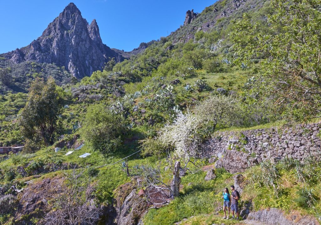
Most of this circular route leads through the protected areas of the Los Marteles Special Nature Reserve. The landscape values are outstanding and, together with the geological formations and rich biodiversity we shall come across, it is a route of exceptional interest from start to end, at Rincón del Tenteniguada after passing through Lomito del Tafetal and Coruña Ravine.
The route starts at about 190 meters from the Plaza del Rincón, at the entrance to a cement road to the right of the Barrancos street. This cement track leads through agricultural areas to the left-hand bank of Coruña Ravine, where the damp environment at this middle altitude and the fertile soil encourage the growth of a variety of plants. The first part of the route leads us to some cave houses and shelter-caves “alpendres” dedicated to traditional uses.
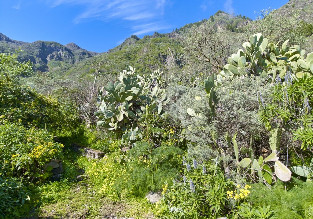
Roque Jincao will be overlooking us as we come to an intersection on the cement track, P1point, where there is a footpath that comes from Cuevas Blancas Dam down Roque Jincao. We will come to a pond on our way and, a little further on, a dirt track that will take us into an area of laurel bushes. There will be species that are typical of this environment, such as Canary figwort (Scrophularia callantha), endemic to Gran Canaria and found throughout Coruña Ravine, and a wide range of species, such as blue tajinaste (Echium callythirsum), tree sorrel (Rumex Lunaria), summit marguerite daisy “magarza” (Argyranthemum adauctum) and giant buttercup “morgallana” (Ranunculus cortusifolius).
After about 870 meters on the road and track, we will come to point: P2 Start of the footpath.
Geology now becomes the protagonist as we come to hillside deposits from the Recent Cycle colonized by plant species that also require high levels of humidity, including may flower “flor de mayo” (Pericallis webbii), “ortigón” (Urtica morifolia ) and canry bell flower “bicácaro” (Canarina Canariensis).
The footpath makes its way upstream until, after about 240 m, we come to point: P3 Optional section to the well. Here, we may take an alternative route for about 210 metres before crossing the ravine. It leads E-W and will take us to a well, point: P4 Well. At the well, which is in use and reminds us of the abundant water resources in this area, there are fruit trees interspersed with native vegetation, an ideal habitat for a rich variety of fauna.
Back at point P3, we shall continue our route in a SW direction up a hill that is colonised by a grove of broom (Chamaecytisus proliferus), a type of bush present almost along the entire route, some of which are of considerable size and are hanging with epiphytic lichens that draw the moisture left by the trade winds in this area.
We shall walk down the basaltic deposits on the hill, home to rock-growing vegetation, including different types of succulents, such as a Gran Canaria endemism, stalked aeonium “oreja de abad” (Aeonium undulatum) that turns the slopes bright yellow from April onwards.
At this point we shall also find common species, from the same family, such as Aichryson laxum, Aeonium percarneum, Aeonium simsii, Aeonium spathulatum or Greenovia aurea.
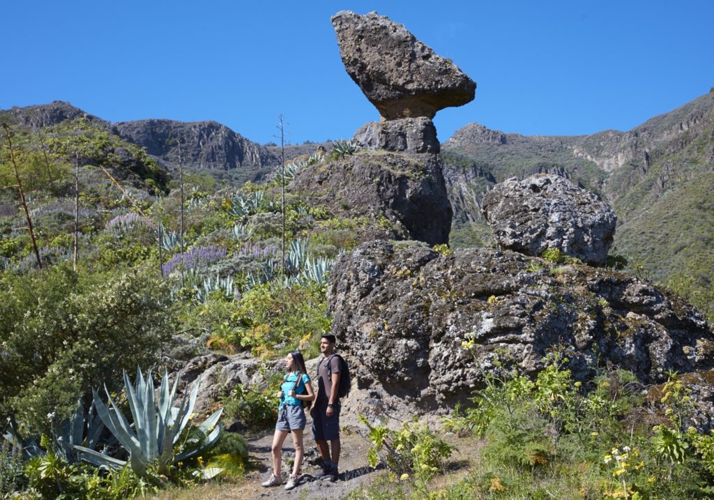
Further up the southern end of the ravine, we shall come to the base of Roque del Pino after covering another 280 metres, point: P5 Roque de la Vela. This is a whimsical natural structure that has survived the effects of erosion to become a viewpoint overlooking the Tenteniguada semi-basin and Roque Grande, as well as the entire municipality of Valsequillo.
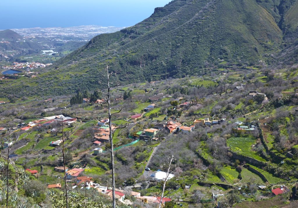
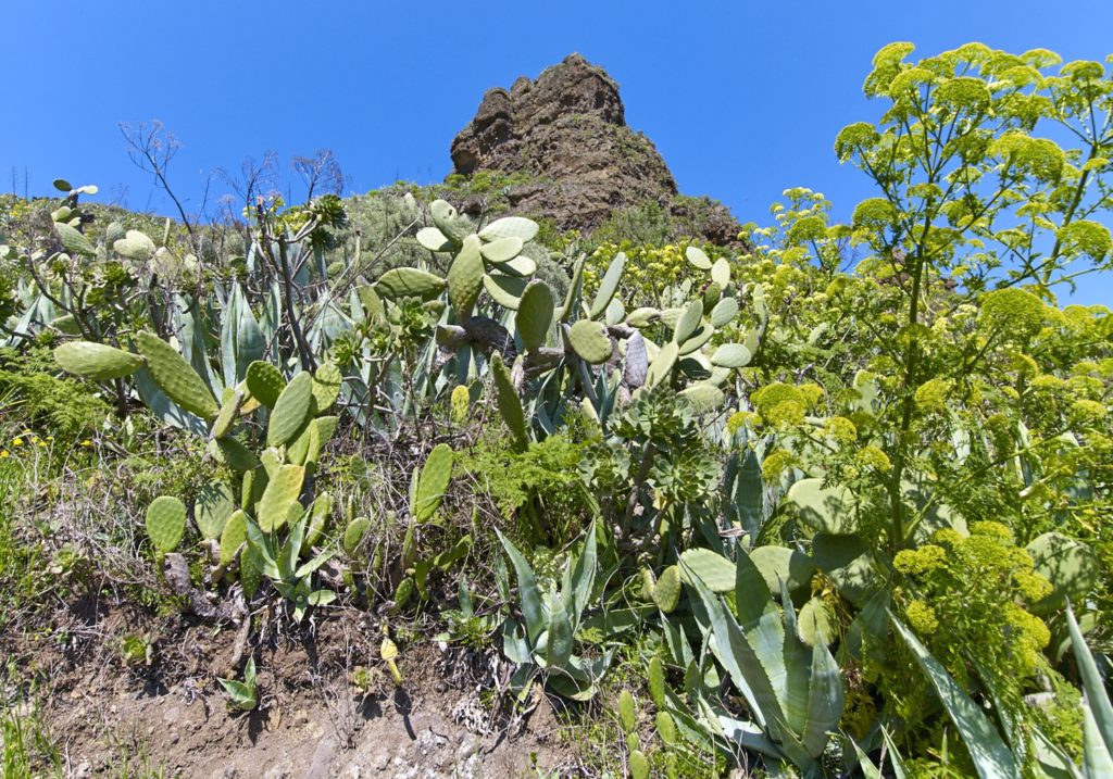
After the ascent comes the descent along the southern face of Lomito Tafetal, heading NE. New plant species will become noticeable on the route and accompany us, such as ginat fennel “cañaheja” (Ferula linkii), a Canary Island endemism. The descent ends in a typical rural mid-altitude environment, where homes, “alpendres” and caves appear alternating with vegetable gardens. After a descent of 430 metres, with some very steep sections, we shall reach point: P6 Paved road.
This section begins at the foot of a paved road heading NE along the highest area of Rincón de Tenteniguada. This landscape is dotted with agricultural plots, which reminds us of the agricultural history of this district, with houses that are over a century old and cave houses and cave-shelters “alpendres” that are still in use, highlighting the popular traditions that are still alive in this area.
We head east on a path for about 270 m., We turn to the north, coinciding with the SL3, and after traveling about 190 m more we reconnect with the road, which takes us in 190 m. more where the route ends, the same as the beginning, the point P7- End El Rincón.
Download the route