SL 4 Presa de Cuevas Blancas – Roque Jincao – Rincón de Tenteniguada
Starting point: Presa de Cuevas Blancas
Altitude: 1665 m
Direction of the Route: NW-NE-SE
Destination: Rincón de Tenteniguada
Altitude: 971 m
Total Distance: 5200 m
Time to cover the Route: 2hr. 45′
Net Difference in Altitude: 728 m
Difficulty rating: Medium
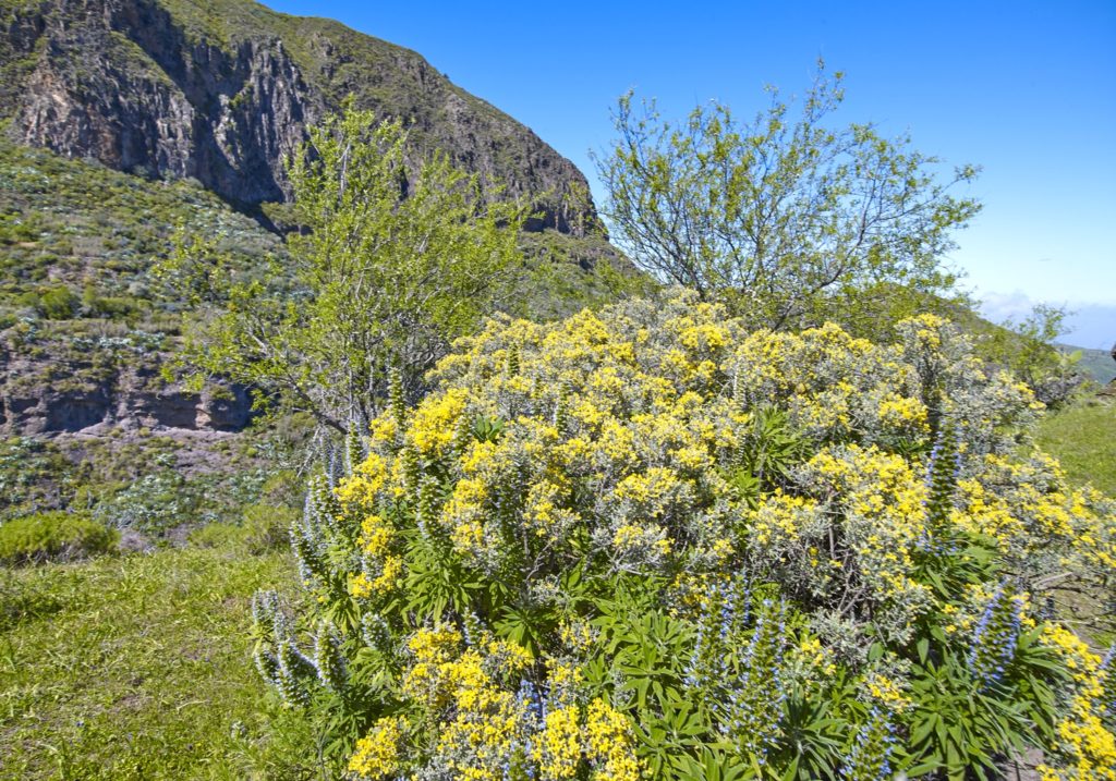
The scenic attractions of this route are determined by the fact that it runs through areas of high natural value in the Los Marteles Nature Reserve and the area surrounding Las Cumbres Protected Landscape.
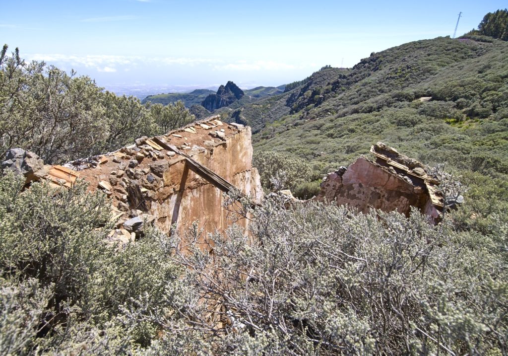
The route begins in a humid summit area next to the GC-130 road from Telde – Los Pechos, at point: P0 Start Cuevas Blancas Dam; the route near the dam runs along phonolite hauynite lava flows. This surface is home to a dense reforestation pine forest that we shall pass on our left while, on our right, we will find summit broom populations (Micromerio benthami – Telinetum microphyllae), endemic to the island summits, the most representative species of which are yellow broom (Teline microphylla), a Canary Island endemism, and thyme (Micromeria benthamii), which are accompanied, among others, by «estornudera» (Andryala pinnatifida pinnatifida) and Canary Island flatpod (Adenocarpus foliolosus). Among the birds, it is relatively easy to see the plain swift (Apus unicolor). This section ends at a small group of caves, next to a house of ethnographic interest, and the route then makes its way up a cement road between farming plots.
After 970 metres, we will reach the foot of Cruz del Saucillo Mountain, point: P1 Cruz del Saucillo. Here, we have the option of a short detour, making our way around the mountain to its summit where, from the Navigator’s Cross (Cruz del Navegante), we will be able to enjoy an exceptional view.
Back on the route, or if we had not taken the detour, a forest track takes us towards Gorda Mountain, surrounded by a reforestation Canary pine forest (Pinus canariensis), the undergrowth of which comprises ferns (Dryopteris oligodonta), endemic to the island, together with other species, such as «cañaleja» (Ferula linkii). This pine forest is an excellent habitat for forest birds, such as the great spotted woodpecker (Dendrocopos major thanneri) and common chaffinch (Fringilla coelebs canariensis), subspecies endemic to Gran Canaria that are characteristic of mixed pine forest areas like this one.
To our right, we shall see expanses of broom-flatpod, and associated plants, where the dominant species are yellow broom (Teline microphylla) and Canary Island flatpod (Adenocarpus foliosus), a Canary Island endemism; we can also can find species like white sage (Sideritis dasygnaphala), another island endemism.
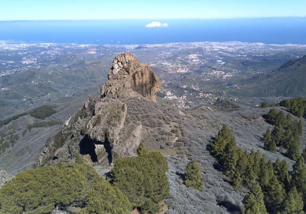
Shortly before leaving the dense pine forest, after about 960 m, we shall find a footpath that leads to the base of Roque Saucillo, point: P2 Footpath to Roque Saucillo.
This is a Pliocene volcanic plug, uncovered by coastal-differential erosion, (Cruz del Saucillo and roque Saucillo are two different formations, separated by a distance of about 1 km). Before proceeding with the route, we can reach the base of the Roque at a distance of about 190 m.
We are surrounded by the landscapes of the north-east quadrant of the island, accompanied by rock vegetation and where we can appreciate the presence of many birds. We shall continue our walk along the forest track that has exited the pine forest and entered broom-flatpod domains in a typical mid-altitude humid environment. This section ends in an area that has been transformed for traditional agricultural use, where most trees are fruit and nut trees, such as wild cherries, walnut and chestnut, near traditional houses.
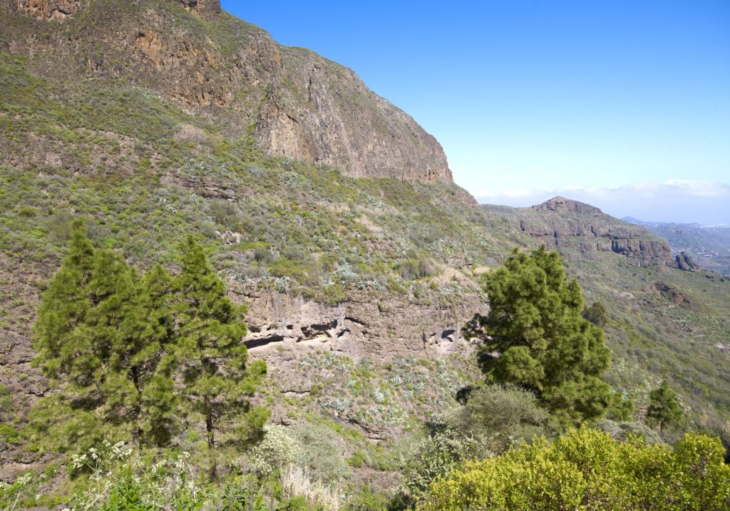
After about 1030 m, before La Capellanía gorge, we shall reach point: P3 Footpath to Rincón. At the foot of a chestnut tree, we shall find a steep footpath on the right-hand side of the track, which we must take as it crosses a dense area of broom-flatpod vegetation. This will take us to a cave pond, on the slope down to the head of Tenteniguada ravine, where we may admire a spectacular geomorphological landscape of volcanic breccias from the Roque Nublo Cycle.
Moisture accounts for new plant species. The blue tajinastes (Echium callytirsum) and «tacarontilla» (Dracunculus canariensis) are endemic species.
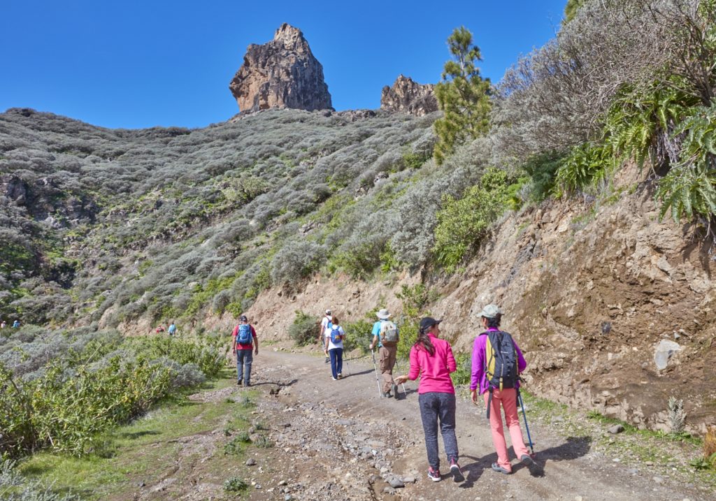
After crossing the head of the ravine, the descent continues through an open pine forest with Valsequillo in view below. Now, after about 780 metres, we shall come to the foot of Roque Jincao, a capricious formation surrounded by spectacular views, point: P4 Roque Jincao. We will be able to enjoy a wide view of the head of the ravine and of the Tenteniguada erosive caldera.
Not without some difficulty, given the moist environment that makes the slope slippery, we shall descend to the NE down an area of high botanical interest. This humid environment is home to a small relict laurel forest with species that enjoy maximum protection, such as the «bella de risco» (Scrophularia callianta), endemic to the Canary Islands, laurel (Laurus azorica), a Macaronesian endemism, Canary ivy (Hedera canariensis), Canary Island smoke bush (Bystropogon canariensis), «bicácaro» (Canarina canariensis), both endemic to the Canary Islands. We shall also find choisy or marjoram (Hypericum grandifolium) and a related species, «cruzadilla» (Hypericum reflexum). Birds are also common in this environment.
The descent ends about 200 metres further on, at point: P5 Water mine. This is a water mine forming a cave pond colonized by a species of fern known as «culantrillo» (Adiantum capillus-veneris). We circled south west toward Coruña Ravine. Here, there are abundant rock-dwelling species, such as «bejeques», Aeonium percarneum and Aeonium undulatum. As we approach the bed of the ravine, the farming terraces increase in prominence in the landscape. About 660 metres further down, we shall come to a dirt road, at point: P6 end of the footpath to Rincón de Tenteniguada.
From there, we shall walk about 550 metres, first on La Coruña ravine track, where blue tajinastes alternate with vegetable gardens, and then, beyond the ravine, on a paved stretch, until we reach point: P 7 End Rincón de Tenteniguada.
Here we find the SL 3 and the SL 1 that can take us to Valsequillo.
Download the route