SL 3 Caldera de Los Marteles – Cuevas Blancas – La Pasadera – Rincón de Tenteniguada
Starting point: Caldera de Los Marteles
Altitude: 1528 m
Direction of the route: NW-NE-N
Destination: Rincón de Tenteniguada
Altitude: 970 m
Total Distance: 4270 m
Time to cover the Route: 2h 45′
Maximum difference in altitude: 696 m
Difficulty rating: Medium-Low
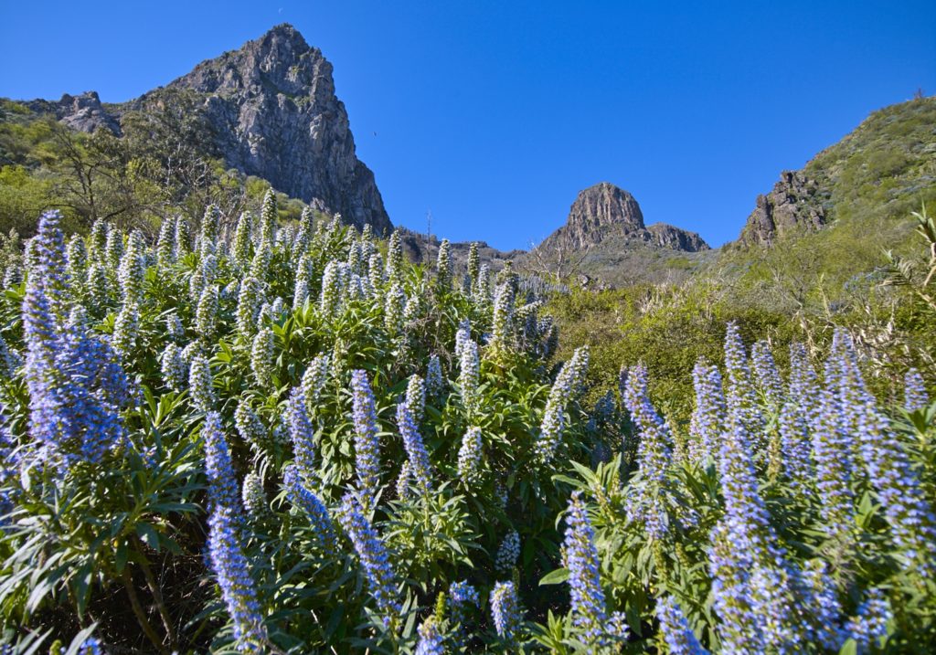
For the most part, this route crosses the Los Marteles Special Nature Reserve and is of great scenic and scientific interest from a geological-geomorphological and biological point of view.
It begins at the foot of the GC-130 road from Telde to Los Pechos, at point: P0 Start. Caldera de los Marteles.
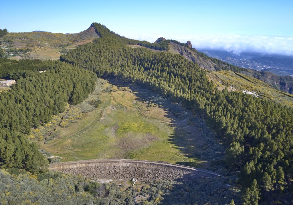
It continues for 1 kilometer in ascent towards NW, through an environment of repopulated pine forest. At the left of the road, until reaching the dam of Cuevas Blancas, point P1, which is in the interfluvium of two hillsides and is formed by a retaining wall of considerable thickness, is made of stone and has an approximate height of 20m. Currently it is usually empty most of the time due to leaks.
Crossing the road the route continues NE direction by a small abandoned dirt track, at a height of 1665 meters, by a surface of haüynitic phonolites, occupied by a community of broom – Canary Island flatpod.
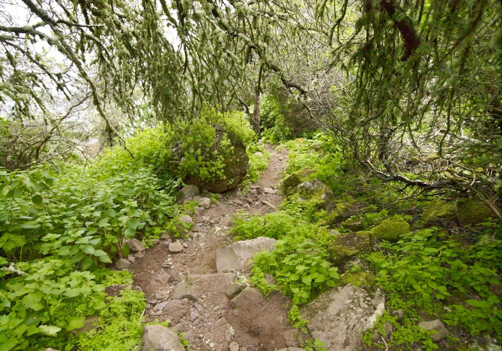
About 250 m along, the footpath begins, at point: P1 Beginning of the footpath, we shall continue through the broom-Canary Island flatpod, interspersed with Bowles mauve (Erysimum bicolor), a Macaronesian endemism, white sage (Sideritis dasygnaphala), endemic to Gran Canaria, and walking over phonolite hauynite lava flows.
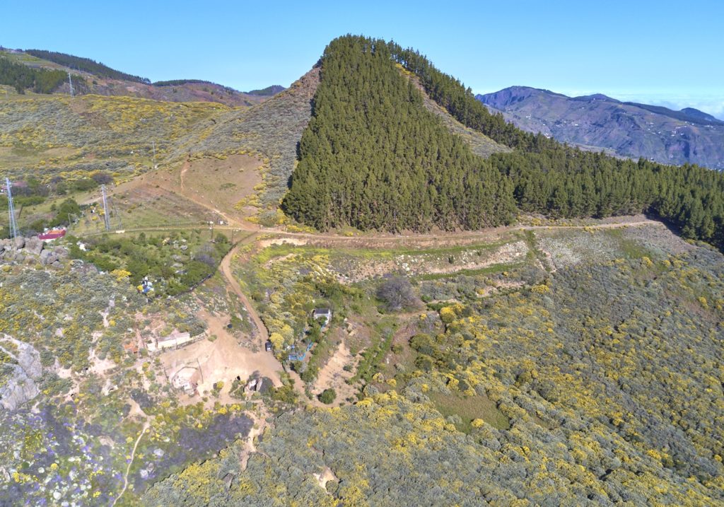
After walking about 380 m to the top of Roque del Pino, at point: P2 Roque del Pino, we come to the domains of the Canary Island flatpod (Adenocarpus foliolosus), endemic to the Canary Islands, and yellow broom (Teline microphylla), which dominate the landscape.
We shall see crows flying overhead, a subspecies that is endemic to the Canary Islands (Corvus corax canariensis) and that is becoming increasingly endangered but that is useful as a scavenger.
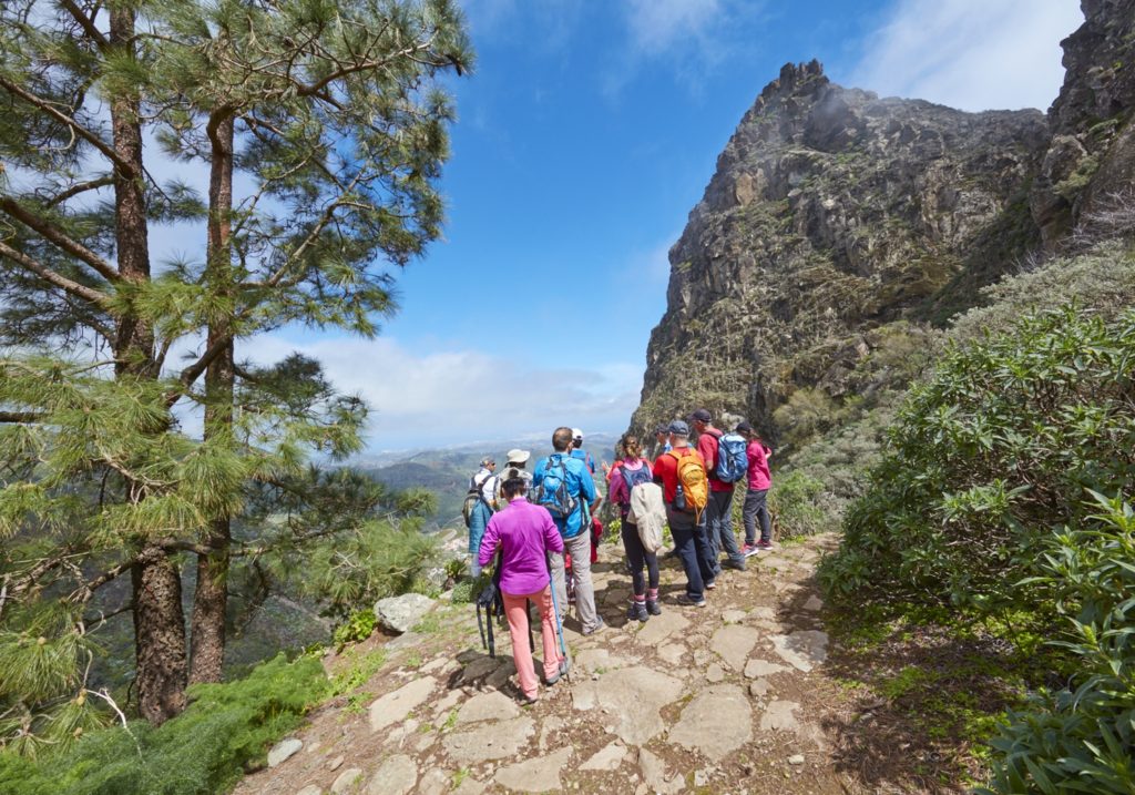
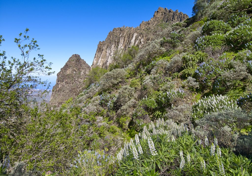
Continuing along the route, we shall turn right towards the head of the La Pasadera ravine. From this point, we shall begin to descend a steep slope through a spectacular landscape formed by Pliocene basalt flows, fragmented by phonolite hauynite plugs that have been exposed by coastal-differential erosion. They are known by the name of “roques”, Roque Grande on the right.
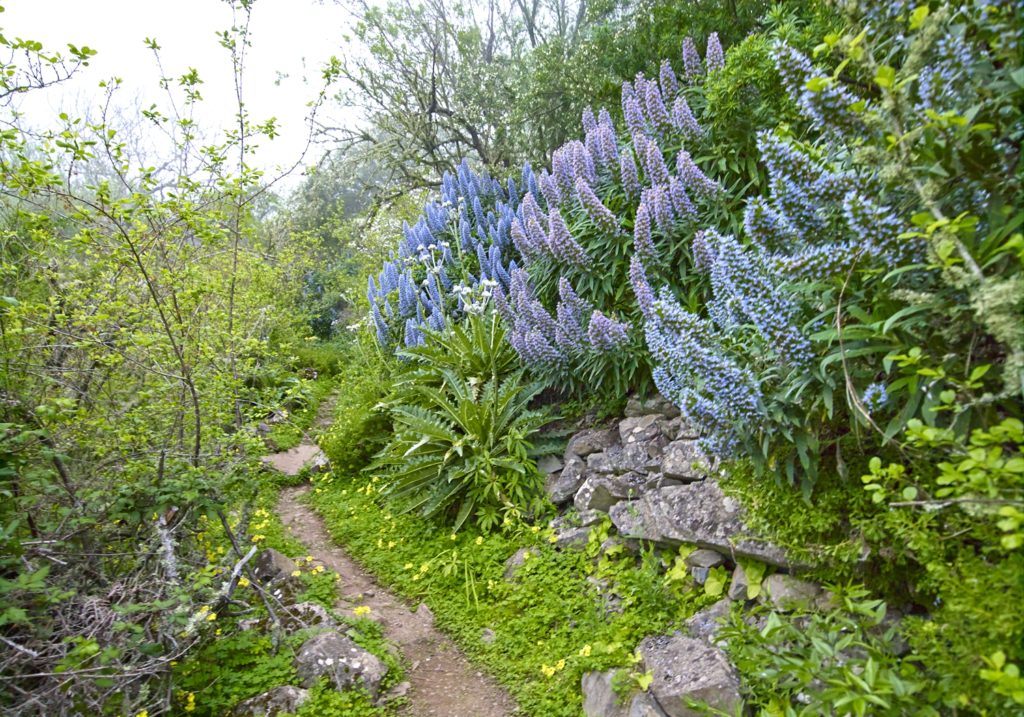
A large number of plant species occupy these flows, among which we can see the yellow broom and Canary Island flatpod, the blue tajinastes (Echium callithyrsum), endemic to Gran Canaria and widespread in the area. Alongside these species, there are other Canary Island endemisms, such as sage (Salvia canariensis), cañaheja (Ferula linkii) or cerraja (Sonchus acaulis).
As we continue, we will come across rock-dwelling species in the most rugged and rocky areas. The rocks are home to very representative succulent species known as bejeques; such as Aeonium undulatum, Aeonium simsii, Aeonium percarneum that are endemic to Gran Canaria, or in the case of Aeonium spathulatum, endemic to the Canary Islands. There are also communities of Greenovia aurea, which defy gravity, and Aichryson laxum in the most humid corners; these latter two species are endemic to the archipelago.
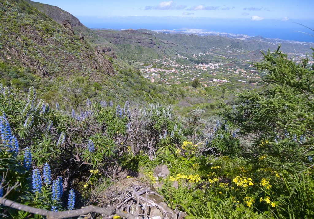
We shall continue for about 700 m until we reach an ethnographic element: a cave-shelter (cueva alpendre), reminding us that this route was used for traditional livestock transhumance. Alongside this “alpendre”, a few metres further on, there is a threshing ground (era), next to a pine tree, which is a natural viewpoint from where we can enjoy a spectacular view of Valsequillo, vertically cut by the majestic Roque Grande to our right, point: P4 Threshing ground –
viewpoint. As we pass the viewpoint area, we shall reach the base of Roque Grande and where we will be able to admire it from one of its most attractive visual perspectives.
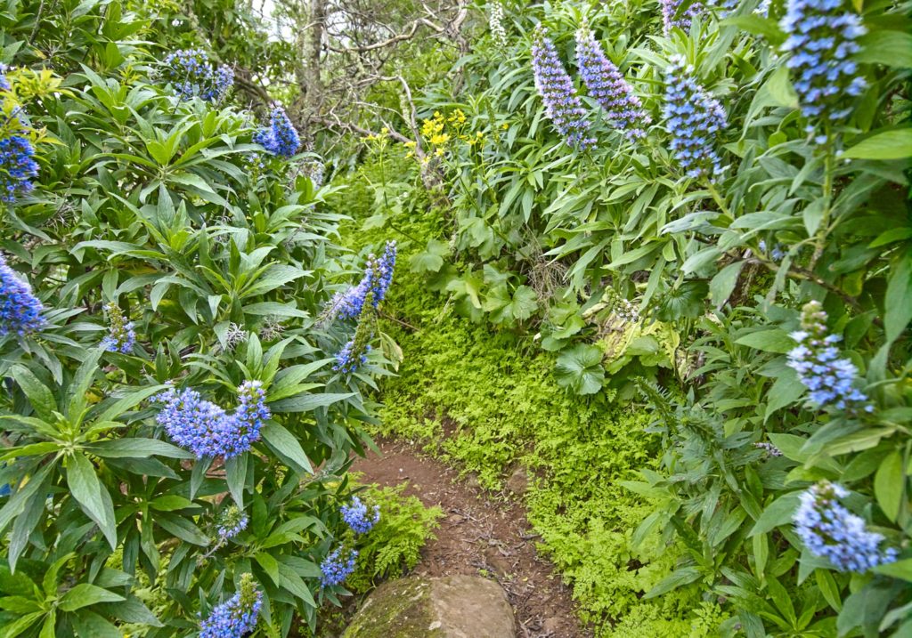
As we make our way down, after about 430 m, we shall cross to the North side of the ravine at point: P5 Ravine crossing point. The environment quickly becomes more humid, as the geomorphology of La Pasadera ravine traps the mist carried by the trade winds. This phenomenon favours the presence of species such as broom (Chamaecytisus proliferus), the Canary Islands nettle (Urtica morifolia), “bicácaro” (Canarina canariensis) or “tacarontilla” (Dracunculus canariensis), endemic to the Canary Islands.
At the lower sections of the route, we shall be in the shade of blue tajinastes, accompanied by broom and “tabaibas” (Euphorbia regis-jubae), which reach a considerable size in this area. Together with them, we shall come across more and more fruit-bearing trees, such as chestnut (Castanea sativa), almond trees (Prunus amygdalus), walnut (Juglans regia) or others, like wild cherry trees (Prunus cerasus). This vegetation attracts many species of birds, including robins (Erithacus rubecula), Sardinian warblers (Sylvia melanocephala), blackcaps (Sylvia atricapilla), Canary Island blue tits (Parus caeruleus teneriffae) or canaries (Serinus canaria).
We shall continue another 480 m along the bed of the ravine until we reach the end of the footpath, where a dirt road starts, point: P6 Road; a few metres further down, there is a water gallery that is still in use.
From this point, we shall continue down for a further 330 m, through an area surrounded by agricultural lots of various types, until we reach the tarmac road next to a dry chestnut tree, at point: P7 Chestnut tree (el castañero).
Here we find the first houses. From here we will continue along a path between crops in N direction, which in 500 meters takes us to P8 End, near the Rincón de Tenteniguada square. Here we coincide with several routes, among them the SL1 that takes us to Tenteniguada and the urban area of Valsequillo.
Download the route