SL 2 Caldera de Los Marteles – Barranco de Los Cernícalos – La Vegas – Valsequillo
Starting point:
Caldera de Los Marteles
Altitude: 1528 m
Destination: Valsequillo
Altitude: 580 m
Direction of the route: SE-NE-N
Total Distance: 11500 m
Time to cover the route: 5h 20′
Max. altitude difference: 1057 m
Difficulty rating: Medium-high
The route includes one of the most interesting areas of the Los Marteles Special Nature Reserve. Los Marteles Caldera and the geomorphological elements of Los Cernícalos Ravine are tremendously interesting in themselves; in addition, the ravine has a permanent water course with waterfalls. No wonder that the biodiversity in the area is so rich, with a major presence of endemic plant species.
The route begins on road GC-130, at point: P0 Start Los Marteles Caldera. From the viewpoint, we have a view of this caldera of phreatomagmatic origins, i.e. an eruption during which the magma comes into contact with water, resulting in an explosive eruption. From here we must walk E along a forest track that leads us into a reforestation pine forest (Pinus canariensis) growing, in this humid summit environment, on phreatomagmatic deposits from the Recent Cycle.
Leaving the pine forest behind, we shall pass an area of Quaternary basalt with pastures and crops that have been abandoned mostly; a fact that has led to their colonization by communities of broom-flatpod, including yellow broom (Teline microphylla), thyme (Micromeria benthamii) and Canary Island flatpod (Adenocarpus foliolosus).
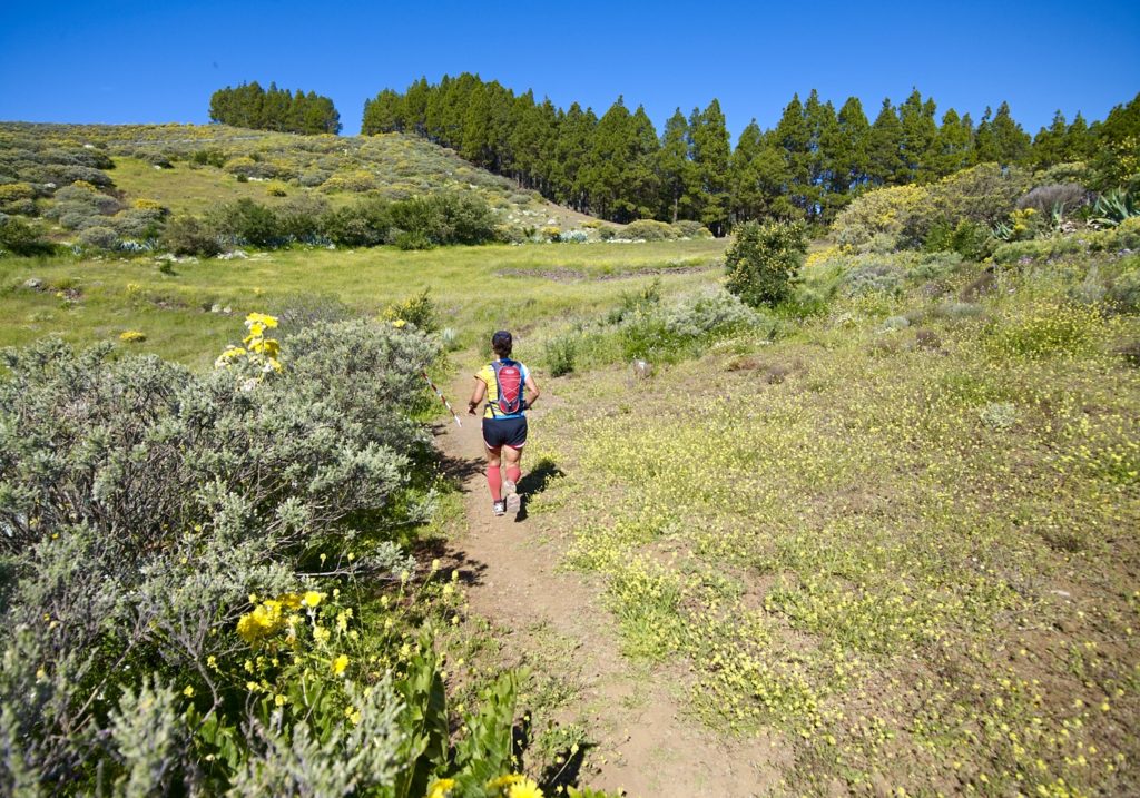
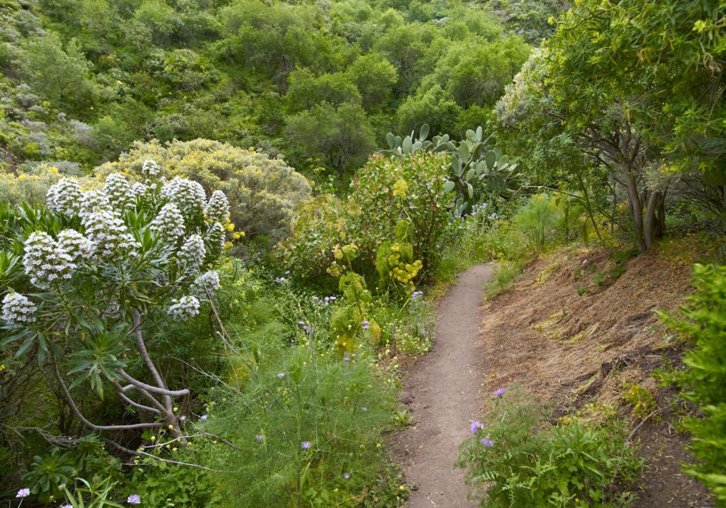
After 510 metres we shall come to the beginning of a footpath on the right. We shall take it at point: P1 Los Cernícalos ravine footpath, at the head of the ravine, heading SW, where we shall begin to see a species that is endemic to the Reserve, Cotton Thistle (Onopordum carduelinum).
We descend by the left margin of the ravine , after about 330 meters we find the point: P2 Shelter-cave (alpendre), that reminds us that we are in a territory of cattle vocation.
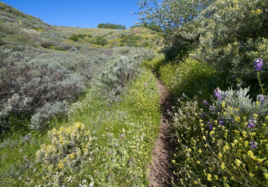
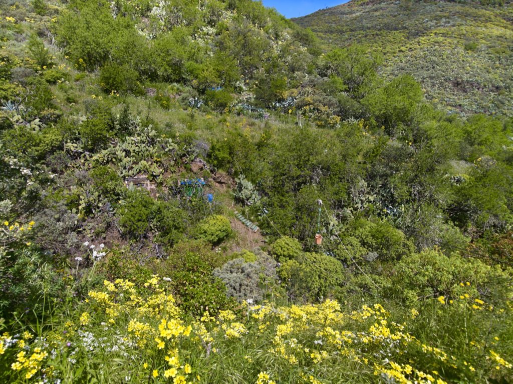
After crossing to the right-hand side of the ravine and walking for about 820 metres, we shall come to a dirt track: P3 track at Cueva Blanca. This part of the route takes us through an area known as Cueva Blanca, where there is a mosaic of small plots of land, with various troglodyte examples of caves and “alpendres” on the left bank of the ravine.The thermophilic vegetation in this area corresponds to a humid environment, as demonstrated by the main community of Gran Canaria wild olives (Olea europea cerasiformis).
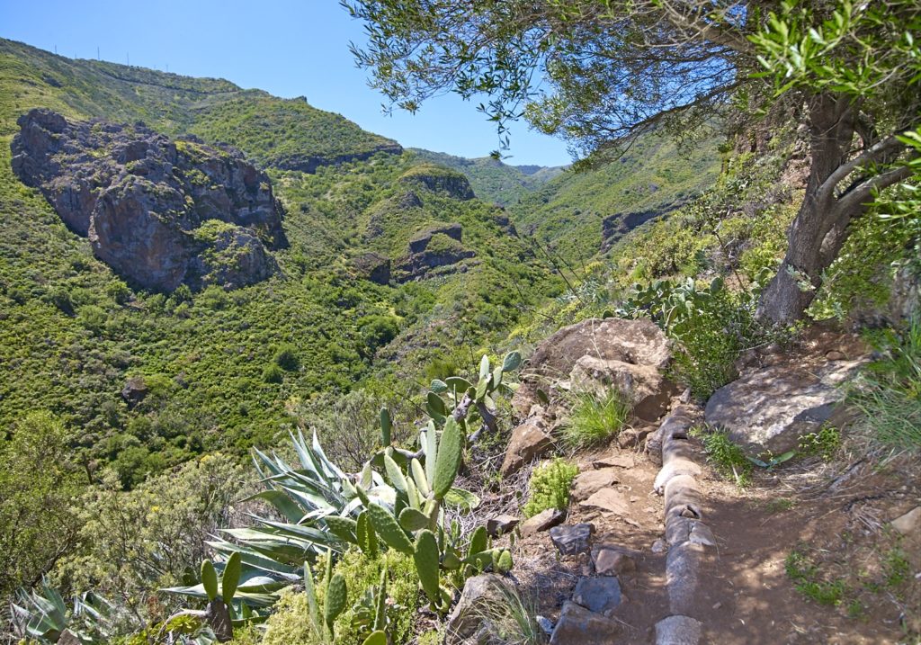
The gorge becomes narrow with profiles in “V”, displaying meanders embedded in volcanic breccias and waterfalls related to coastal-differential outcomes.
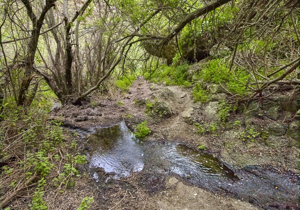
We shall continue along the dirt track on the right-hand bank of the ravine, through this moist environment, for 1080 metres until we reach a footpath at the end. This section begins at point: P4 Willow and wild olive wood. From here we can see a grove of Canary Island willows or “saos” (Salix canariensis). It is the best willow wood in Gran Canaria, a damp forest thanks to a permanent water course. On the slopes, the “saos” give way to wild olive trees, combined with an undertree stratum in which we will be struck by the presence of isolated specimens of “peralillo” (Maytenus canariensis), a Canary Island endemism, and “orobal” (Withania aristata). The flower display is provided by a bush, white broom (Retama rhodorhizoides), while, at herbaceous level, there are two endemic species of the Canary Islands, “bicácaro” (Canarina canariensis) and “tacarontilla” (Dracunculus canariensis).
Here, the kestrel abounds, among other birds, justifying the name of the Los Cernícalos Ravine (the Kestrels’ Ravine). After about 340 m from point P4, we shall cross the ravine and keep to the left-hand bank. Once again, the livestock vocation of the area becomes evident by the presence of a set of caves shelters (alpendres) that are still in use. After crossing to the right-hand bank of the ravine, we shall continue until we cross it for the last time. We are now 1260 metres from P4, where we shall leave the channel along the left bank, at point: P5 Ravine exit.
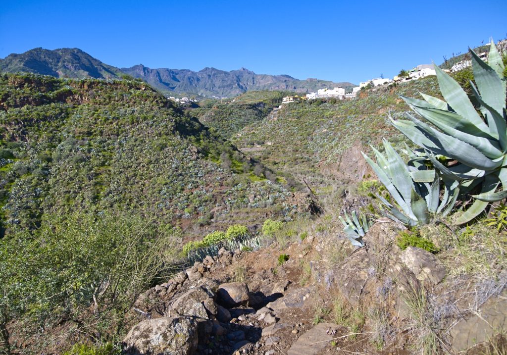
If we look at the geology, we will discover an area of phonolitic haüynite lava that contrasts with the Roque Nublo breccia. We shall start the ascent while observing the humid rock vegetation that has colonized these rocks, such as some “bejeques” (Aeonium percarneum), “cruzadilla” (Hypericum reflexum), “matorrisco” (Lavandula minutolii) and “granadillo” (Hypericum canariense), all endemic to the Canary Islands.
At point P6 Gallery route, about 360 m from P5, we shall find ourselves at the entrance to an alternative section on the right that will take us to point: P7 Guinderos gallery. Here, we shall find a gallery that feeds water into the bed of the ravine. This point is about 260 m to the SE. Once we have returned to P6, the route continues at the feet of some spectacular cliffs.
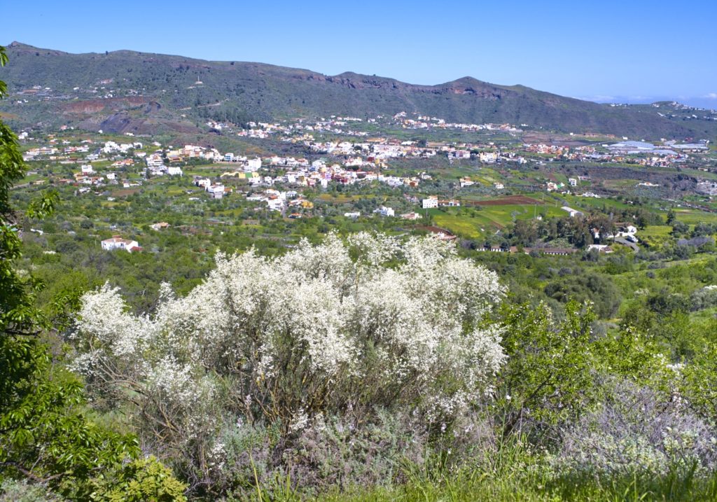
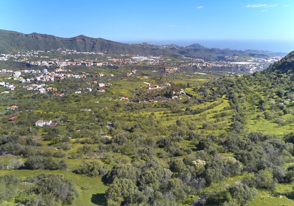
We shall continue walking 900 m to the NE, with spectacular views of the gorge that opens to the sea, and reach point: P8 Forest track. Keeping to the route through the area known as Castillo Hill, we will find a geological formation known as the Roque Nublo Cycle breccia. We shall keep on until we come to the N side of Castillo Hill, from where we will be able to see the town of Valsequillo. The descent down the track leads to an area of fruit-bearing trees, abounding in almond trees (Prunus amygdalus), together with native species, such as “cañaheja (Ferula linkii) or “escobón”(Chamaecytisus proliferus).
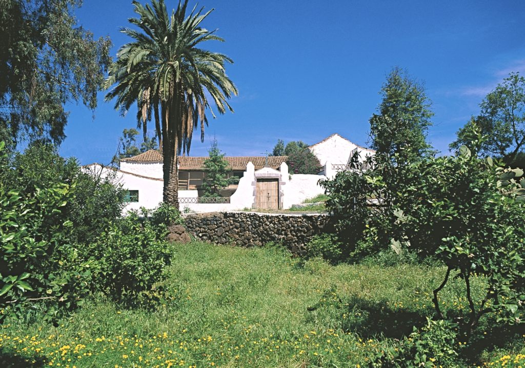
We shall now link to a paved track that will take us in about 3 kmto point: P9 Hacienda de los Mocanes. An example of country architecture, this estate known as Las Haciendas del Marqués del Buen Suceso (Estate of the Marquis of Buen Suceso) already existed in 1851. From this point, we shall walk along a paved road through the Mocanes area.
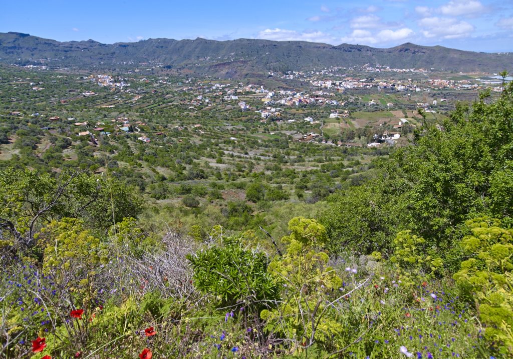
We shall then come, walking about 1170 m more, to Las Vegas, at point: P10 End Las Vegas. Here we start a descent of 230 meters, we passed the Las Vegas school, and after walking 180 meters more between the houses and the crops we reach the P11 Start of the trail.
After walking 240m, we can enjoy a landscape of buildings of ethnographic value, embedded between crops. It is not very difficult to find extremely important vertebrate species endemic to the island, such as the Canary Island lizard or the Gran Canaria skink, which has two subspecies, as well as some birds, such as the Canary Island chiff-chaff (Phylloscopus collybita canariensis), exclusive of the islands or the Canary Island blue tit (Parus caeruleus teneriffae),
We start the descent towards the channel of the ravine, about 360 meters.
Reached the ravine of San Miguel we find in its north margin the point: P13 Vizcaínos Mill, and shows how productive uses have changed, as it is no longer used for grinding the grain and remains as a testimony of former cereal use.
At this point we can choose between the fastest way to reach the town of Valsequillo, with a steep climb of about 410 m to La Silla street. With this option we will enjoy a magnificent view over the upper section of the ravine. If we wish to dedicate more time to know the ravine we head to the E for about 440 meters.
The vegetation now reflects the greater ambient humidity and several species alternate, such as white tajinaste (Echium decaisnei), blue tajintaste (Echium callithyrsum) endemic to Gran Canaria, venenilla (Bryonia verrucosa), may blossom (Pericallis webbii), verodes (Kleinia nerifolia), tabaiba (Euphorbia regis-jubae) endemic to the Canary Islands, dock (Rumex Lunaria). In the channel of the ravine we find a stone wall built to retain the water that flows down the channel and cause infiltration to improve the groundwater level, point: P14 Albarrada.
The road climbs the slope of the San Miguel ravine, for about 310 meters with multiple curves until passing the left side of a large pond.
Here there are abundant rocky species with endemic species from the Canary Islands, such as lavender (Lavandula canariensis), canary salvia (Salvia canariensis), rock rose (Allagopappus dichotomus) and bejeque (Aeonium percarneum), accompanied by other species such as broombush, broom or verodes. We move in N direction until we reach the Chinchemy nucleus where we walk 130 meters on asphalt towards the road, in front of the Calvary. Here we take to the left, by the same road, and 300 meters more take us to the Plaza de San Miguel, point P15, the center of Valsequillo and end of the route.
Download the route