SL 7 Valsequillo – San Roque – La Barrera – El Cardón
Starting point: Valsequillo
Altitude: 580 m
Destination: El Cardón
Altitude: 360 m
Direction of the route: NW-E-S
Total Distance: 11600 m
Time to cover the route: 5 h
Max. altitude difference: 633 m
Difficulty rating: Medium
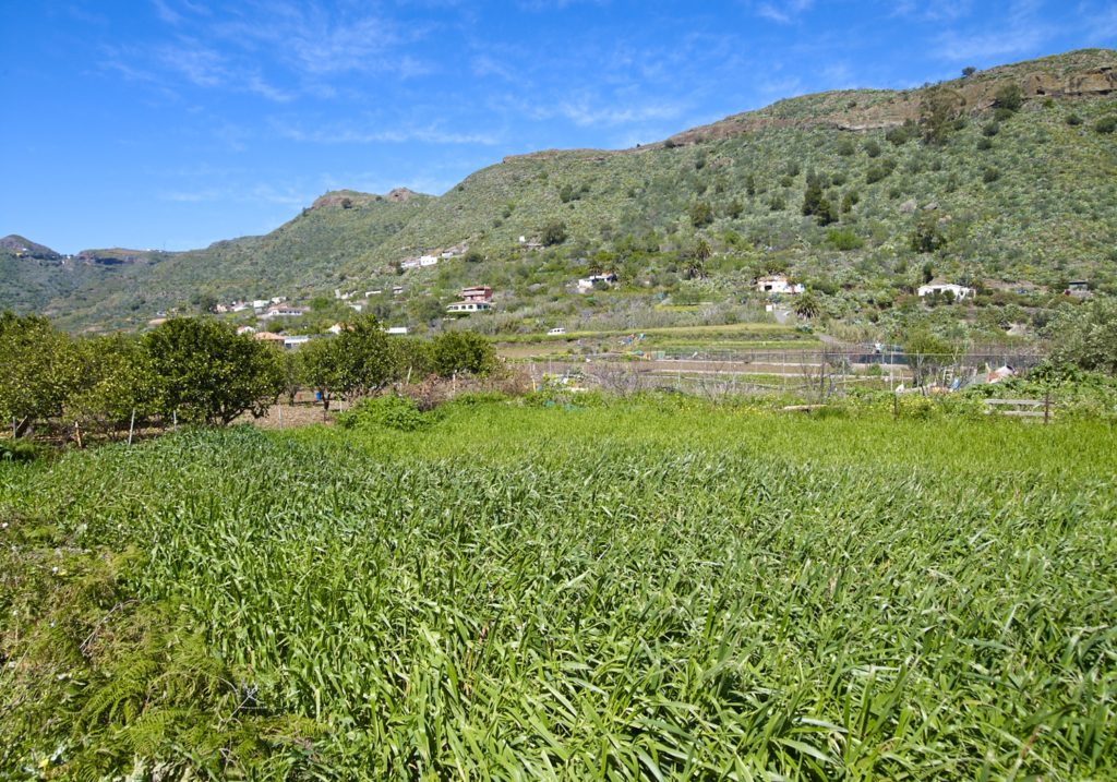
This route is renowned for its ethnographic values related to traditional agricultural and livestock uses.
The route commences at a viewpoint in Sol Street, at point P0 Start Valsequillo. From here, we can see the San Miguel ravine, where the Colmenar Barracks, built in 1530, are located. If we look further up, we shall see San Miguel Bridge and the mill of the Pérez, from the eighteenth century, the oldest construction of this type in Valsequillo. Beyond these heritage sites, the view encompasses the Tenteniguada basin, of exceptional landscape and natural interest.
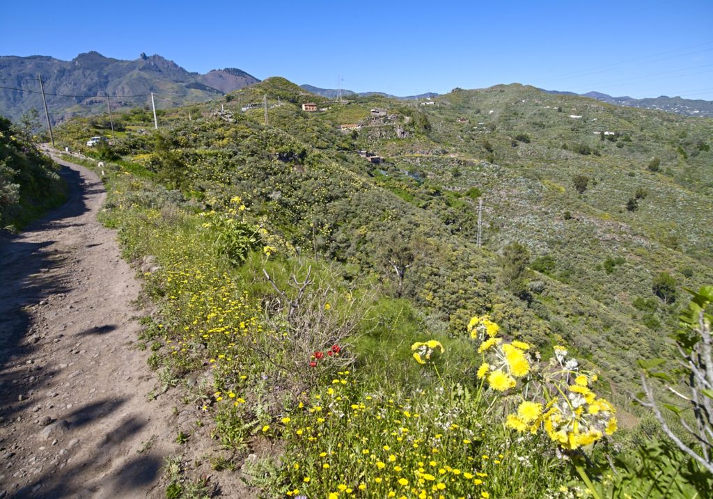
We shall continue West on the paved road that climbs to the Helechal viewpoint. The slope skirts the ravine. We shall pass some houses on the left, cross an intersection and continue in the same direction for about 250 m until we reach point: P1 Caldereta pond.
We shall continue along the side of the road, which turns East, until, after 490 m it will bring us to the beginning of a steep footpath on the left; point: P2 El Helechal footpath.
The footpath takes us up the southern slope of Helechal Mountain for about 250 m with the Caldereta (small crater) on our left. These are two important geological features. If we deviate to reach the top of the Helechal Mountain, , the viewpoint will give us a panoramic view of almost all Valsequillo. This mountain has preserved a religious meaning over the ages. In aboriginal times, it was an Almogaren – place of worship of the ancient Canary Island people. Before we arrive to the roadside, we shall see rock-dwelling vegetation of interest, such as a rock rose species (Cistus monspeliensis) native to the Canary Islands.
Walking along the paved road, while crossing El Helechal, we shall come across traces of traditional agriculture, such as some “alpendres” (shelters), pond-caves and some well-preserved houses. We shall now come to a hill heading north, which we shall follow, after about 830 m from P2, until we reach point: P3 Footpath to Montañón.
This footpath is still used to go to San Mateo and on pilgrimage to Teror. The ancient nature of the road can be seen at our feet: a well-preserved cobbled path bears witness to its historical usage. The rock vegetation takes advantage of the moisture at middle altitudes to grow.
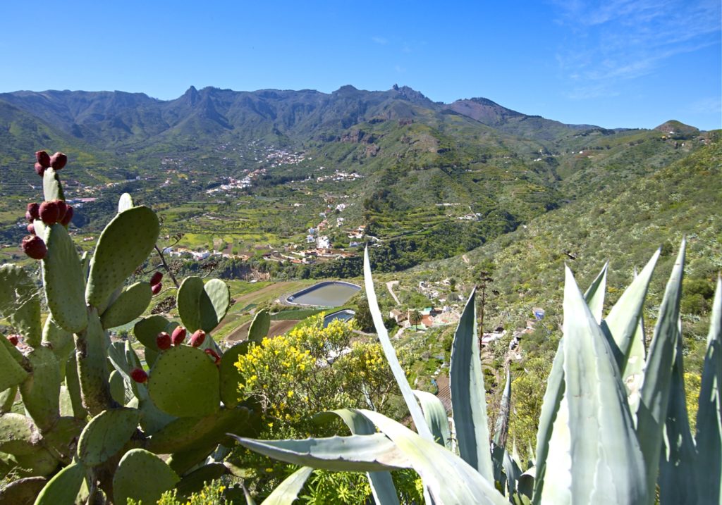
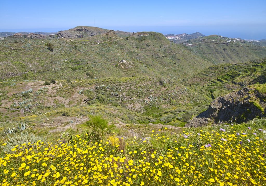
At the summit of the mountain, at an altitude of 860 metres, we reach a natural viewpoint where the view encompasses Valsequillo and parts of San Mateo and Santa Brigida at point: P4 Natural viewpoint.
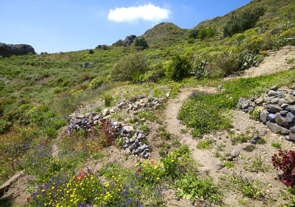
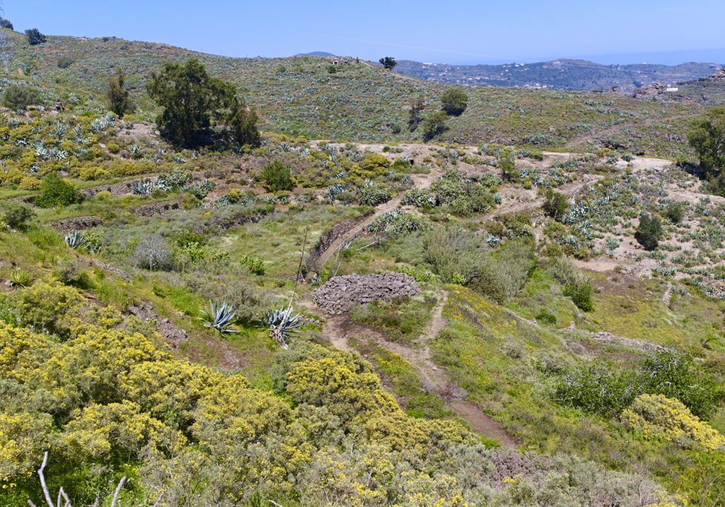
The route skirts the head of the San Roque Ravine where we will find a fork in the track and then another intersection heading NE. The landscape displays how the environment has been adapted to traditional mid-altitude agriculture and livestock activities, which still survives in this area, with terraces, channelled courses, water springs, and alpendre-caves.
Once we have passed the fork, we shall continue along a dirt track until we come to a sharp bend to the right and a footpath. From there, we shall head to the area known as Abejera Alta after walking over 2300 m, to point: P5 Abejera Alta.
The deft hands of country people have left their mark on this landscape of important ethnographic value, where the terrain is modelled into terraces for cultivation – many of which have been abandoned – with stone walls, alpendres and hydraulic works, such as a water mine and the channelling of the ravine, where pear and fig trees thrive.
We shall keep to this old transhumance route for about 860 metres as far as Abejera Alta, at point: P6 Abejera Alta viewpoint. This is a place where we may be able to observe the graceful flight of the buzzard (Buteo buteo insularum), a sample of natural values.
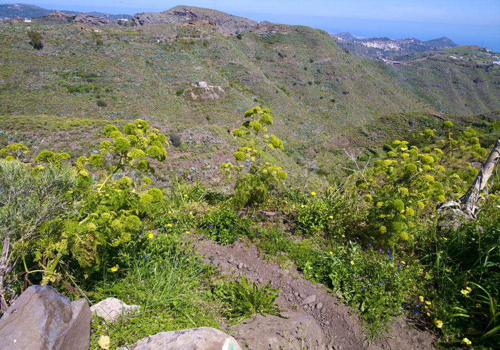
After passing the mountain, we shall begin the descent to the east, between rock formations where there are endemic species, such as “bejeque rosado” (Aeonium percarneum). On the way down, we shall come across more alpendre-caves.
After more than 2000 metres heading East, we shall reach a paved road in an agricultural area at point: P7 Cuevas Negras. We shall make our way across this area of troglodyte habitat that gives its name to the surrounding district. Then we shall cross a the nucleus of houses and head towards Cuevas Blancas (P8).
Here it is convenient to deviate from the route about 800 meters in direction E so we can admire the spectacular San Roque Palm Grove. Together with Canary Island date palms (Phoenix canariensis), we will see a stand of wild olive trees (Olea europaea cerasiformis) at the lowest levels of this thermophilic environment.
Back to Cuevas Blancas, we descent to the San Roque ravine and go up to an area of farms and terraced crops; 2.2 km separates us from point P9, the neighborhood of La Barrera, in the S-SE direction, the last section next to the G-41 road. Here we can go to Valsequillo by road.
If we wish to complete the route walking, in another important natural environment, also known for the large number of aboriginal caves that are often reused, we head for about 900 meters towards the San Miguel ravine. We cross the road in the SW direction, walk through an urbanized area and we walk down to the ravine in the area of Cardón, P10 fin, where we connect with the SL 10 route that follows the channel of the ravine in direction W, for almost 5 km, to the town center of Valsequillo.
Download the route